


INDOOR NAVIGATION SYSTEM
A) GENERATION OF QR CODE:
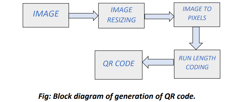
The initial step in navigation process is to generate the accurate floor maps which will help for the indoor navigation. Image resizing reduce the number of pixel data which makes the generation the QR code an easier task. The image format used is binary image. Hence any other format of image is converted to binary image before encoding. RLE is the better way to reduce the number of numeric data and make it affordable for the generation of the QR code. The results of RLE is used in the generation of QR codes.
B) RECOLLECTION OF IMAGE:
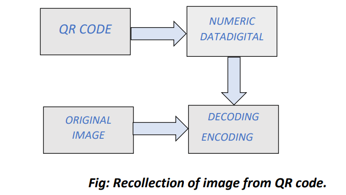
The numeric data obtained from the scanning process of QR code is decoded for getting the floor map image. The inverse process of the run length coding is performed for decoding which helps in recollecting the original image (floor map). The floor map shown in the mobile phones show the current location of the user and direction.
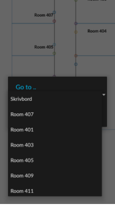
C) WORKING OF APPLICATION:
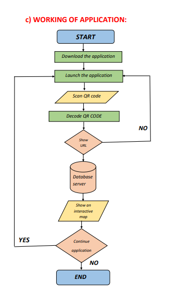
The user downloads the application at the entrance of the building. After the installation and the launching of the app, the user launches a QR code reader, which decodes the QR code scanned by the camera of the smartphone. The application can continue and show the decoded URL, or to terminate it. If the user chooses to view the URL, the application redirects him to the external server, where an interactive map is stored. After showing the map, the application can be terminated or the user can continue with taking the next QR code.
.webp.webp)
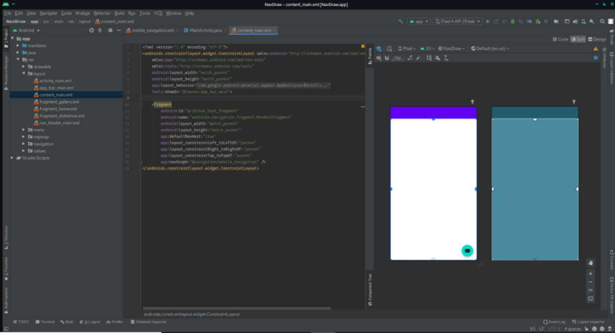
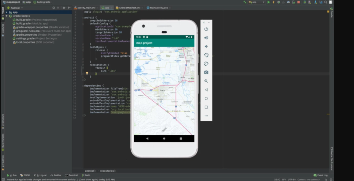
D)App using Android studio
E) CHATBOT:
For the blind and people with low vision, determining their current location is a challenge. If the user gets voice response when he approaches to important places in the building, then they can easily reach their destination in an indoor environment. This application contains the chatbot system. The user will get voice response when he approaches to some important places in the building. This will help the people with low vision to get the advantage of the indoor navigation and can easily navigate to their desired destination.
SAMPLE PROGRAM
#import qr in python library
import qrcode
img = qrcode.make('Some data here')

#qr for image factor
import qrcode
import qrcode.image.svg
if method == 'basic':
    # Simple factory, just a set of rects.
    factory = qrcode.image.svg.SvgImage
elif method == 'fragment':
    # Fragment factory (also just a set of rects)
    factory = qrcode.image.svg.SvgFragmentImage
else:
    # Combined path factory, fixes white space that may occur when zooming
    factory = qrcode.image.svg.SvgPathImage

img = qrcode.make('Some data here', image_factory=factory)
SAMPLE OUTPUT:
UPGRADE:
In our application there is a mode for blind people and people with lower vision. When this mode is enabled chatbot will appear instead of map. This chatbot will guide the person and protect them from obstacles. This feature is carried out with help of TensorFlow.
